
REVIEW · PUERTO RICO
Puerto Rico Unlocked 500+ Hidden Gems and Spots
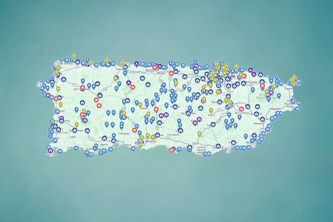
Planning Puerto Rico is the hard part. This self-guided digital Google Map stacks 500+ places into one phone-friendly plan, from river swims to churches and viewpoints, with pins that send you straight to Google Maps.
I like that the content is organized by area, so you can make a logical route instead of hunting around on outdated blogs. I also like the practical extras, photos and tips, plus links that remove the guesswork once you’re driving.
One drawback: there’s no live guide. You’ll still need to handle your own timing, parkings, and especially weather checks when you’re heading toward river spots.
In This Review
- Key highlights worth your attention
- How the 500+ pin map works on your phone
- San Juan start point and how to build your own rhythm
- Day 1 Rio Grande: rivers, waterfalls, and natural pools
- Day 2 Aguadilla: beaches with variety, plus quick snack stops
- Day 3 Lares: scenic viewpoints for big Caribbean views
- Day 4 Aguada: forts, churches, secret tunnels, and colonial streets
- Day 5 Luquillo: a food-focused driving day
- Day 6 Ponce: strange-and-cool stops for the curious driver
- Day 7 Toa Alta: town squares that feel alive
- Day 8 Carolina: sacred sites from cathedrals to hilltop chapels
- Safety, fitness, and what to pack for water and caves
- Price and value for road-trip planners and group budgets
- Who should use this Puerto Rico pin map, and who might not
- Should you book this Puerto Rico pin map?
- FAQ
- Is this map a guided tour with a set schedule?
- How do I navigate to the places in the map?
- What’s included in the purchase?
- Are entrance fees, meals, or transportation included?
- Do I need special equipment for rivers or caves?
- What start point does the experience use?
- When can I access the map?
- Is it safe to visit river spots in bad weather?
- Is it refundable if I cancel?
Key highlights worth your attention
- One-tap pins into Google Maps so you navigate immediately, not after extra searching
- 500+ categorized locations across PR, built for road trips and day-by-day freedom
- Lifetime access with updates, so your map stays fresh as new spots are added
- Starter plan across 8 regions, from Rio Grande rivers to Carolina’s sacred sites
- River-safety reminder included, with a clear warning to avoid visits during rain forecasts
- Group-friendly pricing, sold per group (up to 15) rather than per person
Still narrowing it down? Here is what else we reviewed on this stretch of the island.
- Guided Walking Tour in Ponce★ 5.0 · 136 reviews
- Puerto Rico Countryside Tour with Visit to Waterfall★ 5.0 · 119 reviews
- Panorama VIP Tour in Gran Canaria★ 4.5 · 90 reviews
- Pinones Bar Hopping Beach Food Tour & Caguas River Hidden Gem★ 4.5 · 82 reviews
How the 500+ pin map works on your phone
This experience is basically a smart way to do what you would normally do at home, but faster. You get instant, lifetime access to an interactive Google Map packed with 500+ locations across Puerto Rico. Then you open it on your phone, tap a pin, and it jumps you into Google Maps navigation.
The best part is that it’s meant to save time. Instead of spending evenings comparing blogs, screenshots, and TikTok comments, you’re building a route from pins that are already organized. You also get photos, tips, and links tied to each location, so you’re not starting from zero when you arrive.
Because it’s mobile-first, you can use it anytime. It’s not just a pre-trip tool. If your day goes sideways, you can swap plans on the fly and keep moving.
San Juan start point and how to build your own rhythm
Your map activity starts at Plaza Colón in San Juan (C. de la Fortaleza area). Since it’s self-guided, there’s no marching order and no fixed schedule. The opening window runs essentially all day, 12:00 AM to 11:30 PM across the validity dates listed.
What I’d do with a setup like this is keep it simple: choose a region per day and drive the list. The included 8-day structure is useful as a road-trip framework, not a rule you must follow. You can stretch it for a longer stay, or compress it if you’re short on time.
Also, remember this is a rental-car style plan. The experience is designed around self-drive, and fuel, tolls, and parking are not included. Plan your day like a road-tripper: pick a first stop, then a second nearby, then build in buffer time for the real world (parking, dirt roads, and the fact that people stop to take photos).
Day 1 Rio Grande: rivers, waterfalls, and natural pools
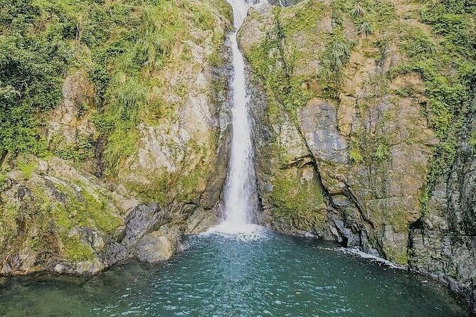
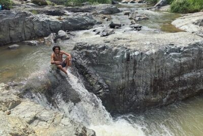
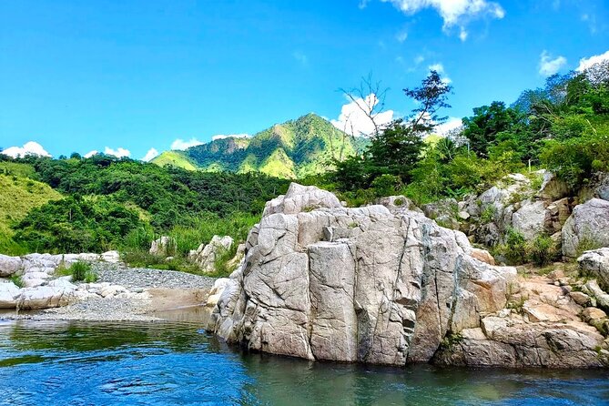
Day 1 points you toward Rio Grande and a big collection of river destinations. The focus here is water time in jungle-like areas: hidden waterfalls, crystal-clear natural pools, and spots that feel like a film set.
Why this day works so well with a pin map: river areas have layers. You might find the main waterfall people talk about, or you might find the smaller pool that’s quieter and easier to spend the day at. With one map feeding you into Google Maps, it’s much easier to compare and adjust without wasting hours.
The main consideration is safety. Rivers can turn dangerous fast during or after rain due to rising water levels and strong currents. The experience explicitly recommends checking the weather and avoiding river visits on cloudy days or any day with rain in the forecast. If you go, go smart: give yourself extra time to turn around if conditions look sketchy.
Day 2 Aguadilla: beaches with variety, plus quick snack stops
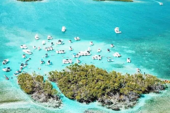
Day 2 shifts you west to Aguadilla, with a collection of 105 beach options. This is one of the strongest parts of the map for people who want variety in a single day. You get beaches that feel untouched and off-the-radar, plus family-friendly options with palms and easy roadside food access.
This is the day where I’d plan a low-stress loop. Pick one “swim beach” and one “walk beach.” Then use the map to swap if the first option is packed, windy, or just not what you pictured.
Since admission is generally free but parking can cost sometimes, think ahead about your beach logistics. Keep cash or a card ready, and be realistic about parking availability on popular stretches. The pin map helps with finding the drive, but the last steps are still Puerto Rico, not a theme park.


Day 3 Lares: scenic viewpoints for big Caribbean views
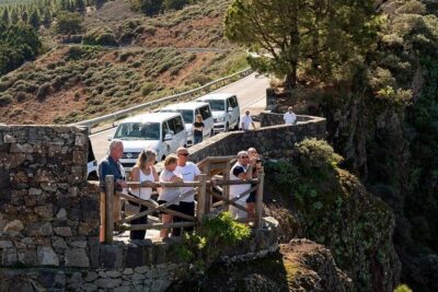
Day 3 is Lares, and the map lines up 21 scenic viewpoints. This is the kind of day that breaks up the beach-and-river rhythm. Instead of searching, you can follow a sequence of outlooks that build toward bigger Caribbean sea views.
What makes this day a good match for a self-guided map is timing. Viewpoints often depend on weather and visibility, and you can adjust as you go. If clouds roll in, you can still move through the list and trade one outlook for another.
One practical tip: viewpoints usually mean winding roads and pull-offs. Drive carefully, don’t rush the stops, and park only where it’s clearly allowed. The map helps you find places, but it can’t control how comfortable you are with curvy back roads.
Day 4 Aguada: forts, churches, secret tunnels, and colonial streets
Day 4 takes you to Aguada, focused on history-type stops. The map includes forts, churches, secret tunnels, and colonial buildings. In other words, you’re not just doing nature. You’re doing Puerto Rico’s built story, walking past places shaped by battles, faith, and resilience.
I like this day because it’s a change of pace that still feels authentic. After days of water and viewpoints, it’s refreshing to slow down and read the island in architecture and street form. Pins make it easier to combine sites that are close enough to do in a day without bouncing between far-apart regions.
A balanced note: these kinds of stops can involve walking, uneven ground, and sometimes limited hours. The map won’t replace on-the-spot common sense. If a site looks closed or inaccessible, move on. The strength here is options.
Day 5 Luquillo: a food-focused driving day
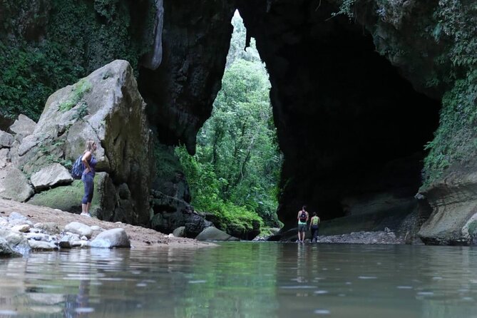
Day 5 is Luquillo, and the map frames it as a tasty road trip with 9 must-stop places. Here the spotlight is Puerto Rican flavor: crispy alcapurrias, fresh mofongo, slow-roasted lechón, and tropical juices.
This is where a pin map shines for people who don’t want to rely on one famous restaurant. Instead, you can build a route around food variety, so lunch doesn’t become a single high-stakes bet.
Since meals are not included, this day can be as casual or as spendy as you want. I’d treat it like a choose-your-own-adventure: do one bigger meal stop and then two lighter snack stops, then finish with juice and a beach walk if you’re still energized.
Also, don’t ignore the practical side. Many food spots are on busy roads or in areas where parking isn’t always convenient. Use the pins, park legally, and give yourself time to get in and out.
Day 6 Ponce: strange-and-cool stops for the curious driver
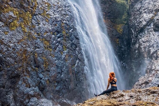
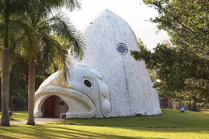
Day 6 heads to Ponce, where the map describes 50+ places that don’t fit neatly into one category. Think hidden tunnels, surreal rock formations, secret waterfalls, giant sculptures, stairways to the sky, and more.
This is your “choose your own adventure” day. If you like weird roadside structures, photo-friendly corners, and short walks that feel like you stumbled onto a story, Ponce is a great match. A pin map helps because it turns scattered ideas into something you can actually plan.
The consideration here is logistics and wear-and-tear. With so many different types of stops, you’ll likely do a mix of driving, short hikes, and stairs. The experience calls for moderate physical fitness, so listen to your body and don’t force every stop.
Day 7 Toa Alta: town squares that feel alive
Day 7 goes to Toa Alta and focuses on town squares, with 50+ plazas. The map frames these plazas as everyday Puerto Rico: live music, children playing, pigeons flying, and old-timers sharing stories under ancient trees.
This is a smart day for first-time visitors because it’s not only about landmarks. It’s about how people actually use public space. And it’s a perfect match for a self-guided map because you can linger. If one plaza feels lively, you stay. If another isn’t the vibe, you skip.
Practical note: plazas can be a little informal in terms of walking conditions. Watch your footing, keep your phone accessible, and be respectful. You’re stepping into daily life, not watching a performance.
Day 8 Carolina: sacred sites from cathedrals to hilltop chapels
Day 8 lands in Carolina with a spiritual journey through 87+ sacred sites. The theme is wide-ranging: majestic cathedrals, humble hilltop chapels, and a sense of architecture connected to deep-rooted faith.
Even if you’re not religious, this day can be worth it. Religious buildings often have strong design, strong local identity, and stories that go beyond tourist scripts. A pin map helps you find more than the “headline” church, because you can compare styles across the route.
Consideration: church hours can vary, and some sites may have restricted access. The map doesn’t promise entry, so treat it like a list of stops to check, not a guarantee. If a door is closed, you can still admire the setting and move on.
Safety, fitness, and what to pack for water and caves
The experience lists moderate physical fitness as a requirement. That’s especially important for river and cave-style stops, where terrain and footing can be uneven and where you might need to move at your pace without a guide.
The most serious safety note is about rivers. You should check weather before you go, and you should avoid river visits if conditions are cloudy or if there’s rain forecast. The reason is straightforward: water levels can rise quickly and currents can get strong.
What that means for your packing, even if the experience doesn’t provide equipment:
- Bring water-friendly shoes if you plan on wet areas
- Bring a dry bag or waterproof phone pouch if you’re carrying electronics
- Keep a backup plan for weather, like viewpoints or churches for the day
Also, remember equipment rental is not included. If you think you’ll need helmets, life jackets, or similar gear, plan to rent it separately, if needed for the specific spot.
Price and value for road-trip planners and group budgets
The price is $29.99 per group, up to 15, with mobile ticket access. That’s an important detail because the value changes a lot depending on how you travel.
If you’re traveling solo or as a couple, it’s still a low-ticket upgrade for saving time and making navigation easier. The map is designed to cut research hours, especially if you hate piecing together outdated directions.
If you have a car full, it becomes even better. When the map is priced per group, the per-person cost can drop significantly compared to paying separate planning tools. You also get lifetime access to updates, so you’re not buying something that goes stale after your trip.
One more value point: admission fees, meals, and transportation are not included. So treat the map as the navigation and ideas engine, not a bundle of attractions. The places are often free, but you should still budget for parking and the occasional paid entry.
Who should use this Puerto Rico pin map, and who might not
This experience is best for you if you want freedom. If you’re comfortable driving, building your own day plan, and making weather calls, the self-guided format is a plus. It also works well for road trips, weekend getaways, and longer stays where you can spread out the regions.
It might be a poor fit if you want someone to handle everything. With no guided tour and no fixed schedule, the map gives you direction and ideas, but you own the logistics. If you’d rather have a driver and live guidance, you might prefer a guided tour instead.
It’s also better for travelers with at least moderate stamina, since some locations involve physical movement. And if you’re not willing to skip river plans when it looks rainy, read the safety warning again before you commit.
Should you book this Puerto Rico pin map?
Book it if you want to cut planning time and drive a route that feels more like real Puerto Rico than a checklist. It’s especially worth it when you want options across beaches, rivers, viewpoints, plazas, and churches, all tied into one navigation workflow.
Skip it if you want hand-holding, or if your plan is only to do a few famous stops in a tight area. The map really shines when you’re moving around and letting the pins shape your day.
If you do book, use it like a tool, not like a script. Pick a region, tap a few pins, and leave room to adjust. That’s where the value hits: fewer wasted hours, more time actually out there.
FAQ
Is this map a guided tour with a set schedule?
No. It’s self-guided digital map access with no guided service and no fixed schedule.
How do I navigate to the places in the map?
You tap a pin on your phone, and it opens Google Maps navigation right away.
What’s included in the purchase?
You get instant digital access to the mobile-friendly Google Map with 500+ curated locations, photos, tips, links, and lifetime access to updates.
Are entrance fees, meals, or transportation included?
No. Admission/entrance fees, meals, and transportation are not included. Fuel, tolls, and parking are also not included.
Do I need special equipment for rivers or caves?
Equipment rental is not provided, so you should plan any needed gear separately.
What start point does the experience use?
The meeting start point is Plaza Colón (C. de la Fortaleza area) in San Juan, and it ends back at the meeting point.
When can I access the map?
The listed access hours are Monday through Sunday, 12:00 AM to 11:30 PM, within the date range shown.
Is it safe to visit river spots in bad weather?
You should check weather first. The experience warns that rivers can become very dangerous during or after rain and recommends avoiding river visits on cloudy days or when rain is forecast.
Is it refundable if I cancel?
No. The experience is non-refundable and cannot be changed, and the amount paid is not refunded if you cancel or amend the booking.
Everything Else We Reviewed in Puerto Rico




Newest Puerto Rico Reviews
- Yunque Rainforest Waterslides Plus Beach Tour
★ 5.0 · 3 reviews - ToroRoller
★ 4.5 · 3 reviews - Scuba Dive and Snorkel Private Charter in Puerto Rico
★ 5.0 · 3 reviews - Largest Natural Waterslide, River Hike and Beach Tour in Arecibo
★ 5.0 · 3 reviews - Luxury Private Tour to Fajardo Keys—Snorkeling & Island Adventure
★ 3.5 · 3 reviews